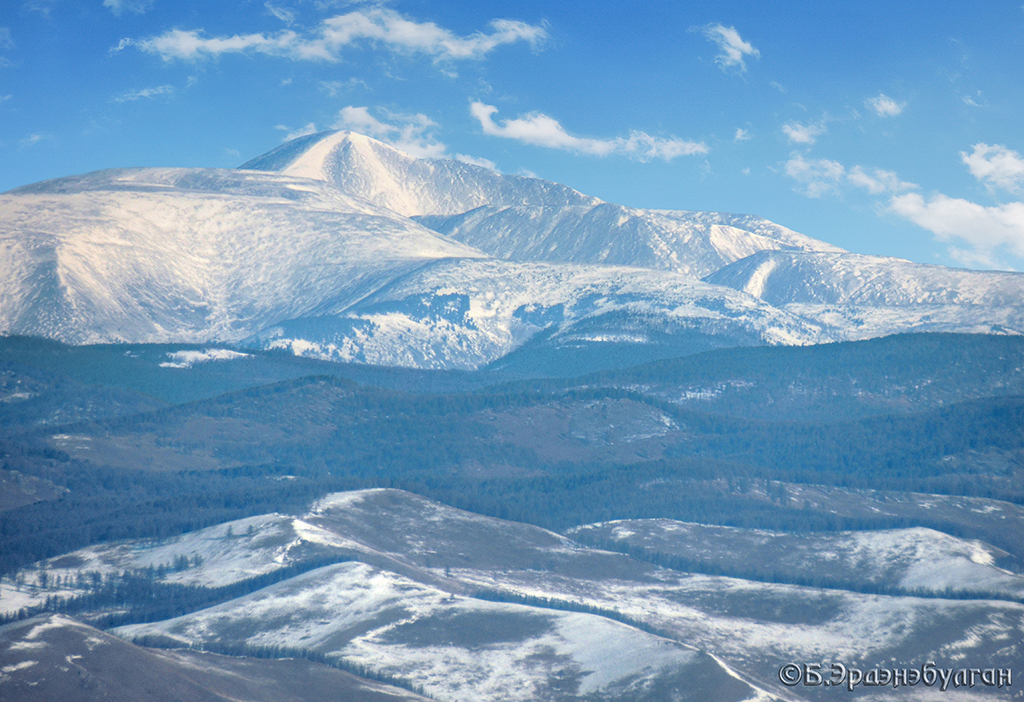
Asralt Mountain
Location: Erdene soum, Tuv province
Coordinates: 48 ° 27’92.1 “N 107 ° 24’75.3” E
Brief information: Asralt mountain is the highest peak of Khentii mountain range and is located at 2800 meters above sea level, N 48 27.928, E 107 24.759 coordinates. Territorially, it belongs to Erdene soum of Tuv aimag. To the south of Asralt Mountain, at the beginning of Gurvan Bayan, there are many beautiful mountains such as Altan Ulgii, Saikhan Saridag and Navtan Saridag. Asralt Mountain is located in the middle of the deep forest and taiga of the Khentii mountain range, in a pristine desert with many kinds of wild fruits and berries. Asralt mountain is suitable for traveling through Zaan Terelj, Tsagaan Nuga and Sognogor.
Khentii Range: The Khentii Strictly Protected Area covers an area of 1,227,074 hectares and covers a large area in the central part of the Khentii Range in northeastern Mongolia. The Asralt Mountain is the highest peak of the Khentii Mountains, at 2,799.3 meters above sea level. The snow cover on the top of Asralt Mountain does not melt in some summers. Mongolian climbers first climbed in 1951. The Khentii Strictly Protected Area covers the territory of Batshireet and Umnudelger soums of Khentii aimag, Mungun Morit, Erdene and Batsumber soums of Tuv aimag, and Mandal and Yeruu soums of Selenge aimag. The distinctive feature of the Khentii Range is that it receives the most precipitation, and it has a dark forest that is difficult to cross with rivers, swamps, and rocks.